 |
||||
10th February 2006 - Wellington to Blenheim (South Island) - 3hrs on the ferry and 47 km After a wonderful ferry crossing from Wellington through the Marlborough sounds in the South Island, we headed straight on the too busy SH1 to Blenheim to meet our hosts for the night, Louise and Paul. As it happened, we found out that they were living 5 miles North of Blenheim only when we reached the town centre and when it started to seriously rain. So after cycling back 5 miles we reached their house totally soaked to the bones! Luckily they had a garage and some spare beds so we were dry and more importantly the bikes had some warmth and cover for two nights.
|
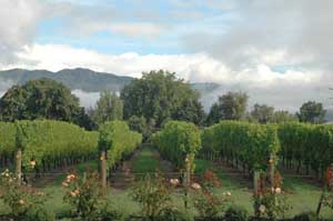
The view from Paul and Louise's garden terrace - all vineyards and mountains |
|||
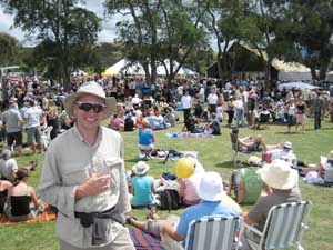
The Marlborough food and wine festival - absolutely packed full of people eating mussels, whitebait and drinking wine.
|
11th February 2006 - Blenheim food and wine festival This was a really hard day for our cycling performance. We were invited by Simon and his boss Mike (thank you Opus!) to go to wine tasting sessions and sample local varieties of Sauvignon Blanc and Pinot Gris amongst many others. And the food was not bad either! If it tastes good, surely it cannot be bad for cycling, can it? In the evening, Louise our host put together and impressive and oh so delicious barbeque meal. Plenty of energy for the tough ride of the new few days! |
|||
|
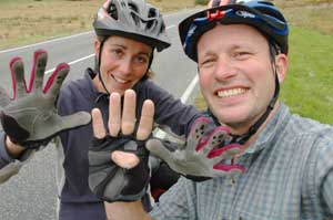
(above) Terry and Chris doing a spot of research for the website - in this case Sauvignon Blanc, Chardonay, Pinot Gris, Pinot Noir and Merlot (left) Simon and Louise also undertook some extensive Sauvignon Blanc research - the results were inconclusive |
|||
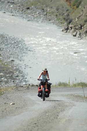
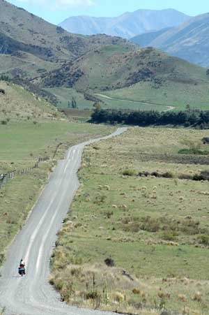
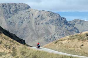
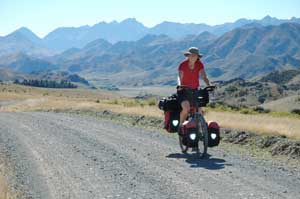
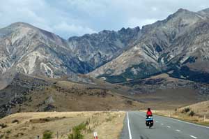
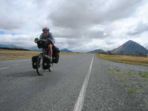
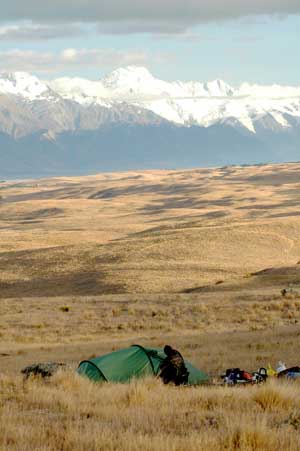
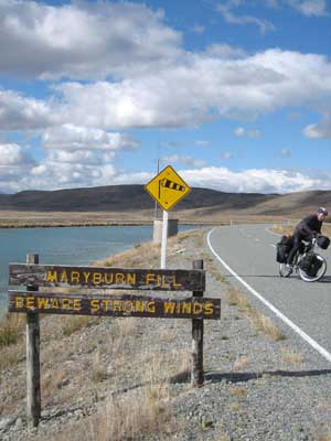
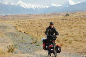
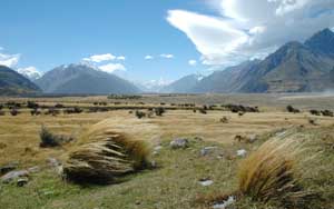
11th to 16th February - Blenheim to Hanmer Spring on the Molesworth Station Track - 202 km The open landscape on this awesome 200 km gravel road makes you feel really really small. The bleak mountains and the immensity of the river valleys strangely reminded us of Mongolia, especially with the fantastic blue sky we had for the last two days. We even met two horse riders gathering their cattle. The only thing missing were the white Mongolian gers/yurts! It is well worth recommending this track. It is quiet and never dull and if it was not for the sheep lorries lifting clouds of dust as they pass by, it would be perfect.
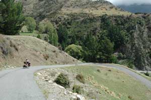
One of many steep climbs where the road climbs to avoid small bluffs next to the river
|
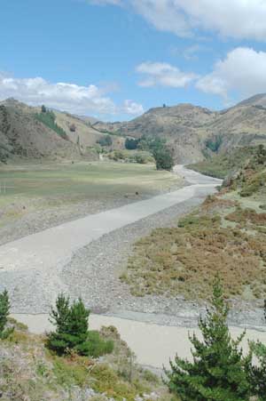
The river Awatere winding towards the coast, the Molesworth road follows the river for 100km |
|||
In the first 2 days we climbed nearly 2000m with an elevation gain of only 800m - up and down all day, on gravel at 14% makes for weary cyclists at the end of the day
|
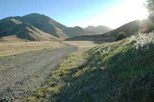
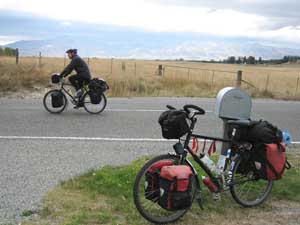
The Molesworth road is open to traffic in January and February subject to fire risk, but it's open to cyclists most of the year (but permission must be sought from the landowner)
|
|||
|
|
|||
View towards the craggy peaks of the 2880m peak of Tapuae-o-Uenuku - the highest New Zealand mountain outside of the Southern Alps
|
The gravel roads were slower and dirtier but this route should be on all cycle tourist's itinerary in New Zealand
|
|||
The beautiful and remote Acheron river valley
|
Sunset in the Clarence valley next to Acheron Cob Cottage
|
|||
17th February 2006 - Hanmer Springs to Sylvia Flat Hot Springs - 61 km After a quick dive into Hanmer Springs hot springs, we turned westwards to Lewis Pass - not quite a direct route to go to Christchurch, but we wanted to see the Lewis and the fierce Arthur Passes for ourselves. We climbed all day on a road that was too wide and too fast (especially compared to the Molesworth road). Terry has now a new favourite whinge: straightened and widened roads. There were many roadworks on that section and all seem to be part of a devilish plan to take the fun out of cycling. The already quite steep winding road is turned into a wider and even steeper road. No turns, no wiggles: the poor cyclist is face with steep wide straight nasty slopes followed by even steeper downhill. Great for the cars, obviously! (except the cars no longer have bends to negotiate so they drive faster allowing the local police to raise more money in speeding fines)
|
The Ferry Bridge at Hamner, a spot to try a bit of bungy jumping - unfortunately our hectic schedule meant that it would have to wait till next time for us |
|||
|
We stopped at Sylvia Flat Hot Springs, hoping for a free treat. But the sandflies found us before we found the springs in the middle of the river. For those who don't know what a sandfly is: it is the campers' worse nightmare. They are really keen little blackflies, usually hanging around in gang of hundreds. They are here to welcome you when you set camp, they are here to check what is in your plate while you eat, and they will patiently wait on your tent door for you to come out in the morning. Need I add that their bite draws blood, is painful and itches for weeks? Took by surprise by a cloud of pesky sandflies, we gave up on closely inspecting the river bed for hot springs and dived into the cold water free from their voracious bite!
(left) Isa at the top of lewis pass
|
|||
18th February 2006 - Sylvia Flat Hot Springs to Reefton - 83 km After a swift porridge topped with dead sandflies, we kept on climbing towards Lewis Pass in the midst of the thick beech forest that covers all the mountains of the area. The climbing was for once quite gentle and Isa did not realise she has climbed Lewis Pass until the downhill started! After climbing the Rahu saddle, it was all downhill to Reefton, the biggest town of the area. Reefton, now a sleepy place, has been once the richest town in New Zealand thanks to its gold mining. It was the first town to have electric street lighting (backed by a small hydroelectric power station) in 1888. We were surprised to find the town full of cowboys (real cowboys!) and live country music being played in the local pub. We learnt that we have just missed the Reefton Rodeo on bulls. But the day was not lost. Talking to a Greymouth forestry man, he gave us the trick to avoid sandfly bites: you must drink a teaspoon full of methylated spirit every morning! Peace guaranteed. |
Isa studying the atlas for a route that avoids the insatiable sandflies
|
|||
A lovely Hanging valley
|
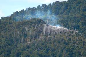
Near Reefton, this old coal mine fire has been burning for the last 50 years
|
|||
Lewis Pass was the first of our passes over the Southern Alps, at 918m high it wasn't a big challenge - avoiding the sandflies was!
|
||||
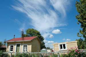
A typical wooden New Zealand house - and sleepout/garden shed |
19th February 2006 - Reefton to Moana - 90 km We started what should have been an easy day, all downhill to lake Brunner next to Moana. Unfortunately, the wind was strongly blowing against us and our progress was considerably slowed down. But this gave a chance to 10 years old Salomon to catch up with us on his old mountain bike. He was really interested in our trip and invited us for tea back at his place. We were so surprised, coming from countries where ten years old are taught not to speak to strangers, that we could not refuse and we spent the next hour drinking earl grey with Salomon's dad, amidst a few of his eight children.
|
|||
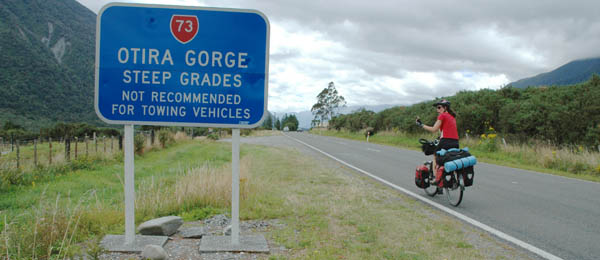
The approach to Arthur's Pass was full of warnings for towing vehicles - it didn't stop huge road train-trucks from tearing up the incline with millimetres to spare for cyclists
|
|
|||
If only it were true
|
||||
20th February 2006 - Moana to Klondyke corner (Arthur Pass) - 77 km The impressive mountain scenery was matched by an even more impressive climb. The road headed straight up for Arthur Pass through the Otira gorges. Some of its sections are 20% on the inside corners and in comparison, the 11% steep viaduct spanning the Otira valley at the end of the climb is a doodle. But the views on top made the effort (and the feeling of loosing your legs and making your heart explode) worth it: rugged mountains topped with glaciers were waiting for us. It was beautiful. Unfortunately the weather was turning to rain, so we did not get a chance to explore the area more closely and carried on towards Christchurch and the better weather of the East coast. |
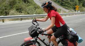
Isa struggling for breath on one of the steeper sections of Arthur's Pass. It is unrelentingly steep for 4 km and then it's downhill to Arthur's Pass Village. |
|||
 |
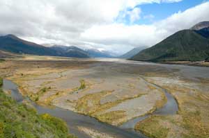
(above) The wide open glacial valley of the river Waimakairi south of Arthur's pass (left) Isa and Terry on top of Arthur's Pass
|
|||
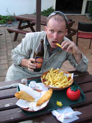
Speight's beer and fish and chips - a nourishing high energy meal as recommended in Lance Armstrong's latest training manual
|
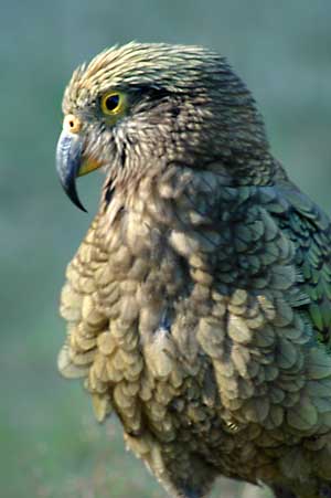
21st February 2006 - Klondyke corner to Springfield - 80 km The campers' no.2 enemy is the kea. Whot's this I hear you say? Well, it is a big green mountain parrot. It has two characteristic: being very very cheeky and very very hungry. From 5 o'clock, six naughty specimen started to mess with our bikes and panniers. We took in turn to get out of our sleeping bags half naked, run and shout at the keas. They would walk a few metres further and give us about 20 minutes rest bite before attempting further inquest into our bags. We therefore started a bit tired on the rolling way to Porter pass. The mountain scenery was awesome and very varied with limestone rocks, lakes and caves. Porter pass marked the end of the Alps and the beginning of the flat Canterbury plain. It also was the best downhill we had in New Zealand. Very fast! Looking back on it, it looked as nasty and steep as Arthur's pass. We set camp in Springfield domain campsite (well recommended!). There we met two villagers, no, don't even think of it - it was not Homer and Marge, but Mel and Val, who invited us for tea the morning after. |
|||
All campers should be very wary of these buggers. The Kea, a mountain Parrot, is noisy, intelligent, inquisitive and always hungry. We were awoken by a gang of 6 Keas trying to break into our panniers and fly off with our bikes
|
It was good to realise that our initial thoughts were confirmed - Ice Cream is not unhealthy, sweet rubbish - it is in fact "Food" - just what a tired cyclist needs.
|
|||
21st February 2006 - Springfield to Christchurch - 72 km The sun was shining and the wind was for once blowing in the right direction! This was going to be a fast day and a flat one too, so we took our time to leave Springfield and went to meet Mel and Val in their cottage. We had a longer chat than expected with this lovely couple, who enjoyed picking up cyclotourists by the side of the road and inviting them for tea! There is not much going on in Springfield and this is their way of socialising. And a rather pleasant way too: we ended up staying for lunch and being offered home made jam! |
The descent before the next uphill before the next descent to climb Porter's Pass
|
|||
Isa with her new funky birthday T Shirt - unfortunately red attracts bulls and sandflies
|
Terry trying to go as fast as possible whilst taking his time to take in the fantastic scenery
|
|||
|
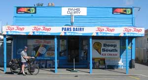
(above) Tip Top ice cream on sale everywhere |
|||
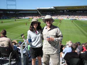
New Zealand V West Indies one day international at the Jade Stadium in Christchurch
|
Once on the road, a few records were set, to Terry's delight. It was our flattest day ever (we climbed 32 m) and also our fastest day with an average speed of 28 km an hour! Woohooo! 22nd to 27th February 2006 - doing many things but cycling in Christchurch We had a rather busy stay in Christchurch as we had to deal with a worn out wheel rim for Terry, a laptop shaken to death on the Molesworth road and an international cricket match (Isa had a compulsory invitation to this one)! |
|||
28th February 2006 - Christchurch to Rakaia - 75 km Unfortunately, the wind that made us reach speed records before reaching Christchurch decided to start blowing again. And this time it it did not work in our favour! It took a few coffee and cake stops to keep us going on this dead flat road! We made it to Rakaia, Salmon fly fishing capital of NZ. Unfortunately this summer was far too hot and dry for the salmon - they are spending their time in the cooler more refreshing waters of the pacific - very unfortunate for the 500 senior fisherman who were at the campsite for the annual salmon fishing competition. |
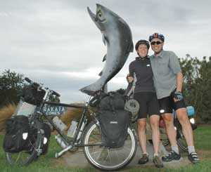
Rakaia - Salmon capital of New Zealand
|
|||
14,000 kms on the windiest, most tiring day so far in New Zealand
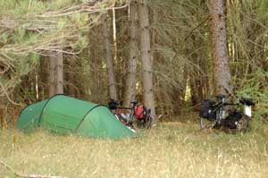
At last - a nice wild camping spot, away from the road, no sandflies and sheltered from the wind
|
1st March 2006 - Rakaia to Geraldine - 86 km We thought the wind was bad yesterday, but in the morning strong gales started blowing. They were blowing from the North-West and making us swerve all over the road. A lady we met expained that it was a "Nor Wester" and "That's what Canterbury is famous for". We met a friendly farmer, who summarised in half an hour the water problems of the Canterbury plain, the globalisation of New Zealand farming, the history of the area and the weather conditions. As for the weather, he told us that the clouds forming ahead announced a Southerly (wind) was on the way. At present, we were still fighting against the Northwesterly. At the end of the afternoon, there would be one minute of calm and then the wind would suddenly start blowing from the South. Hearing this, we tried to reach as fast as possible the only turn of the day, which was a turn to the South. Unfortunately, the weather was as quick as us and we soon were struggling against Southerly headwind. Raaaah!!! And with the Southerly came the bad weather from the Antarctic and we ended up the day in cold wet rain! |
|||
2nd March 2006 - Geraldine to Burkes Pass Village - 74 km Finally, the wind eased off and as we got closer to the mountains, the road started getting a bit more interesting, despite the many buses shifting jet-lagged tourists from Christchurch to Queenstown. The day finished with us finding an unlocked gate and a great wild camping spot amongst a lovely pine forest. |
|
|||
The top of Burkes Pass - easy except for that vicious "Nor Wester" (wind)
|
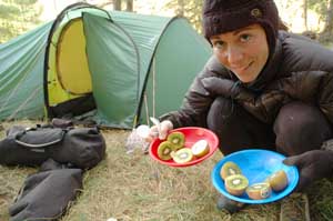
A healthy start to the day - followed by the standard issue bowl of steaming porridge. "It sticks to the ribs" according to nutritionists
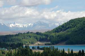
Lake Tekapo and snow capped mountains behind |
|||
The hydro canal between Lake Tekapo and Pukaki |
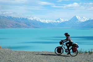
3rd March 2006 - Burkes Pass Village to Lake Pukaki- 53 km Another easy cycling day turned rather painful because of the strong Southerly winds! All day we struggled, through the flat McKenzie basin and along the canal road that links lake Tekapo to lake Pukaki. To compensate for the pain, we had fabulous views of both lakes. The sun turned them turquoise blue and in the background the snowcapped Mt Cook range was dominated the landscape. We planned to cycle all the way to Lake Pukaki but eventually gave in to the fierce headwind and found a spot to wild camp overlooking the lake and the Mount Cook range.
|
|||
Unforgiving winds along the hydro canal brought a early finish - but with a fantastic view across to Mount Cook - the wind made cooking very difficult
|
The warning signs were in the wrong direction. Everything was difficult in these conditions - even basic requirements such as breathing! The Hydro canal is a great way to avoid the busier highway but is brutally exposed to the wind - cyclists beware. |
|||
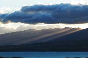
Sunset over Lake Pukaki
|
An early and cold start to the day but what a fantastic view to motivate the muscles |
|||
4th March 2006 - Lake Pukaki to Glentanner (Mount Cook) - 58 km Beautiful sunny day, still very windy but this time it did not matter as much because we took the turn off North to Mt Cook village. Finally it seemed easy! We did not progress much today: in the evening, we could see our camping spot from the night before - on the other side of the big lake Pukaki!
|
Lake Pukaki and the Mount Cook range in the background. The lake colour is caused by the suspended rock dust, which also means no reflections - just like a vampire
|
|||
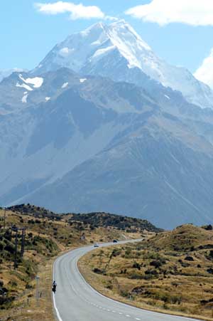
The road from Glentanner to Mount Cook. We were blown left, right and centre and in the end gave up and took the bus the next day - it was too dangerous
|
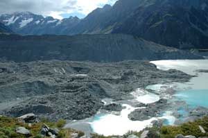
5th/6th March 2006 - Mount Cook On our first day, we attempted to ride up the 22 km to Mt Cook village but the vicious West wind scared Isa: she did not like being pushed into the middle of the road or swerving in front of the too fast, too frequent tourist buses. We turned around and came back to our campsite in Glentanner, feeling like a couple of lightweights. At least on the return journey we only got blown off the road! On the second day, we took a bus and finally got up close with some glaciers (the Hooker and Moeller glaciers more specifically). Due to the rapid retreat of the glaciers the terminal areas are quite desolate to look at - all rocks and grey water. Due to the perceived danger in the area there are only 4 or 5 short walks to do around Mount Cook village so it wasn't possible to get any closer to the glaciers - unless by helicopter, plane or a $1250 guided route! So it's back on the bikes then. Mount Cook dominates the whole valley by its sheer size. So Terry was amused to hear an American tourist saying: "Mt Cook is soooo small, the Rockies are way bigger". Yankees always seem to do it bigger and better! |
|||
The tussock grass bending over sideways in the wind - looking up towards Mount Cook
The end of the Moeller glacier and the 100m high lateral moraine wall - unfortunately the photo doesn't show how strong the wind was blowing.
|
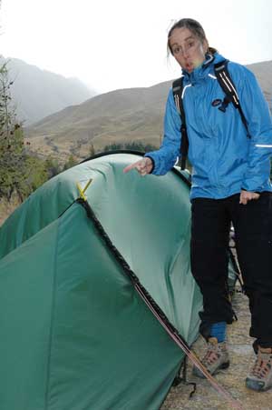
Our return to the campsite showed the power of the wind - broken tent poles and a ripped flysheet - time for bodged repairs and elephant tape
|
|||
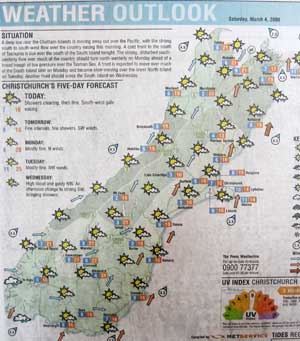 |
(left) The weather forecast from the local paper - all red arrows - red to represent the colour of a cyclists face as they battle into the 80km/hr headwinds Please follow the link for our next page - Dunedin via the Otago Central Rail Trail |
|||
|
||||